
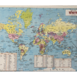
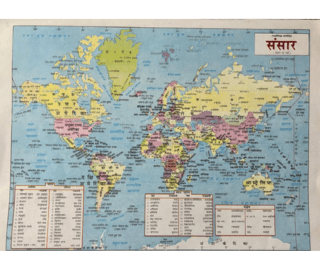


This World Political Map is an excellent educational tool designed to help students understand global geography clearly and effectively. The map displays all countries of the world in different colors, along with their political boundaries, capital cities, major oceans, seas, and continents.
Perfect for classrooms, study rooms, libraries, and coaching centers, this map supports visual learning and enhances geographical awareness.
| Product Type | Educational Map |
| Map Name | World Political Map |
| Usage | Educational & Reference |
| Suitable For | Students, Teachers, Classrooms |
| Size | 22cm x 27cm (Approx.) |
Best For
School & College Students
Teachers & Educators
Competitive Exam Aspirants
Geography Learning
Classrooms & Libraries
General Knowledge Improvement

Reviews
There are no reviews yet.