
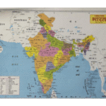
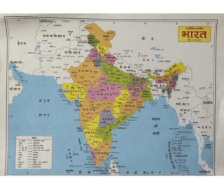
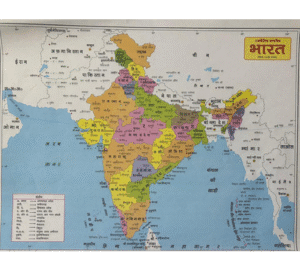


This India Political Map is a highly informative educational chart designed to help students easily understand India’s administrative divisions. The map clearly displays all states and union territories in different colors, along with their boundaries, capitals, major cities, and surrounding water bodies.
Suitable for classroom, study rooms, libraries, and coaching institutes, this map serves as a long-lasting reference tool for daily learning.
| Product Type | Educational Map |
| Map Name | India Political Map |
| Usage | Educational & Reference |
| Suitable For | Students, Teachers, Classrooms |
| Size | 22cm x 27cm (Approx.) |
Best For
School Students
Teachers & Educators
Competitive Exam Aspirants
Geography Learning
Classrooms & Study Rooms
Coaching Institutes


Reviews
There are no reviews yet.